In this episode of ‘My favourite item, unraveling Brisbane’s history piece by piece’ we sit down with Bill Kitson, retired Senior Curator of the Museum of Lands, Mapping and Surveying, who helps...
In this episode of ‘My favourite item, unraveling Brisbane’s history piece by piece’ we sit down with Bill Kitson, retired Senior Curator of the Museum of Lands, Mapping and Surveying, who helps us understand the story behind a special topographical map from their collection.
Want to visit?
The Museum of Lands, Mapping and Surveying is open Monday to Friday, 9:30am to 4:00pm. It is located on the Ground floor, 317 Edward Street, Brisbane.
With special thanks
Mr Bill Kitson, retired Senior Curator of the Museum of Lands, Mapping and Surveying.
Know something more about this item?
Post a comment! Moments in history are shared experiences and helping museums find out more about items in their collection is a great way to become involved in documenting Brisbane’s heritage.
Music
Aliaksei Yukhevich, Light Corporate, jamendo.com, Licensed.
Image
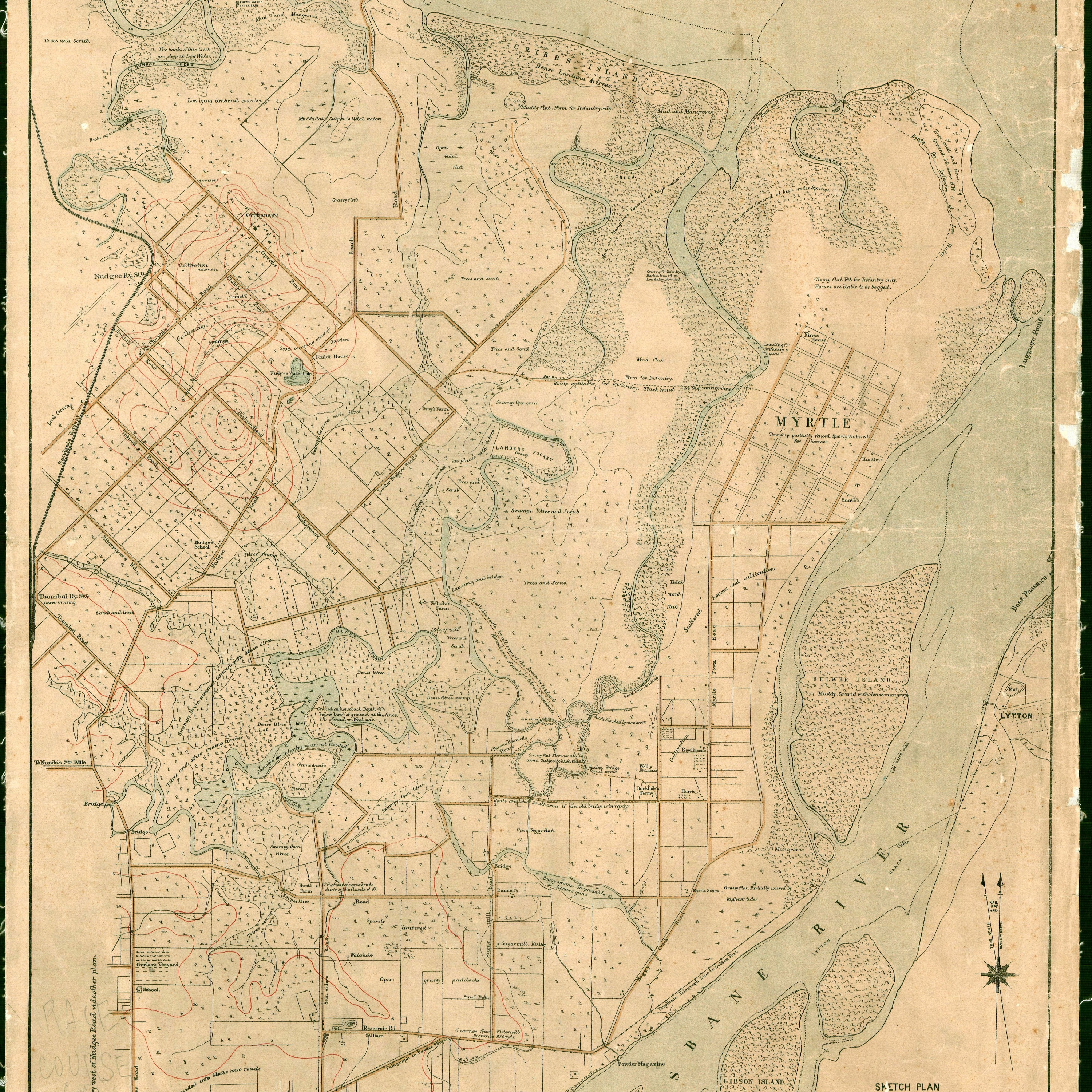
Topographical Map covering the mouth of the Brisbane River, 1 October 1889. Creative Commons Attribution 4.0 International (CC BY 4.0) licence.
Map is available here: https://data.qld.gov.au/dataset/historical-topographic-map-series-queensland/resource/6d910827-b053-4eba-ae54-ffea4a943380

 iOS
iOS Android
